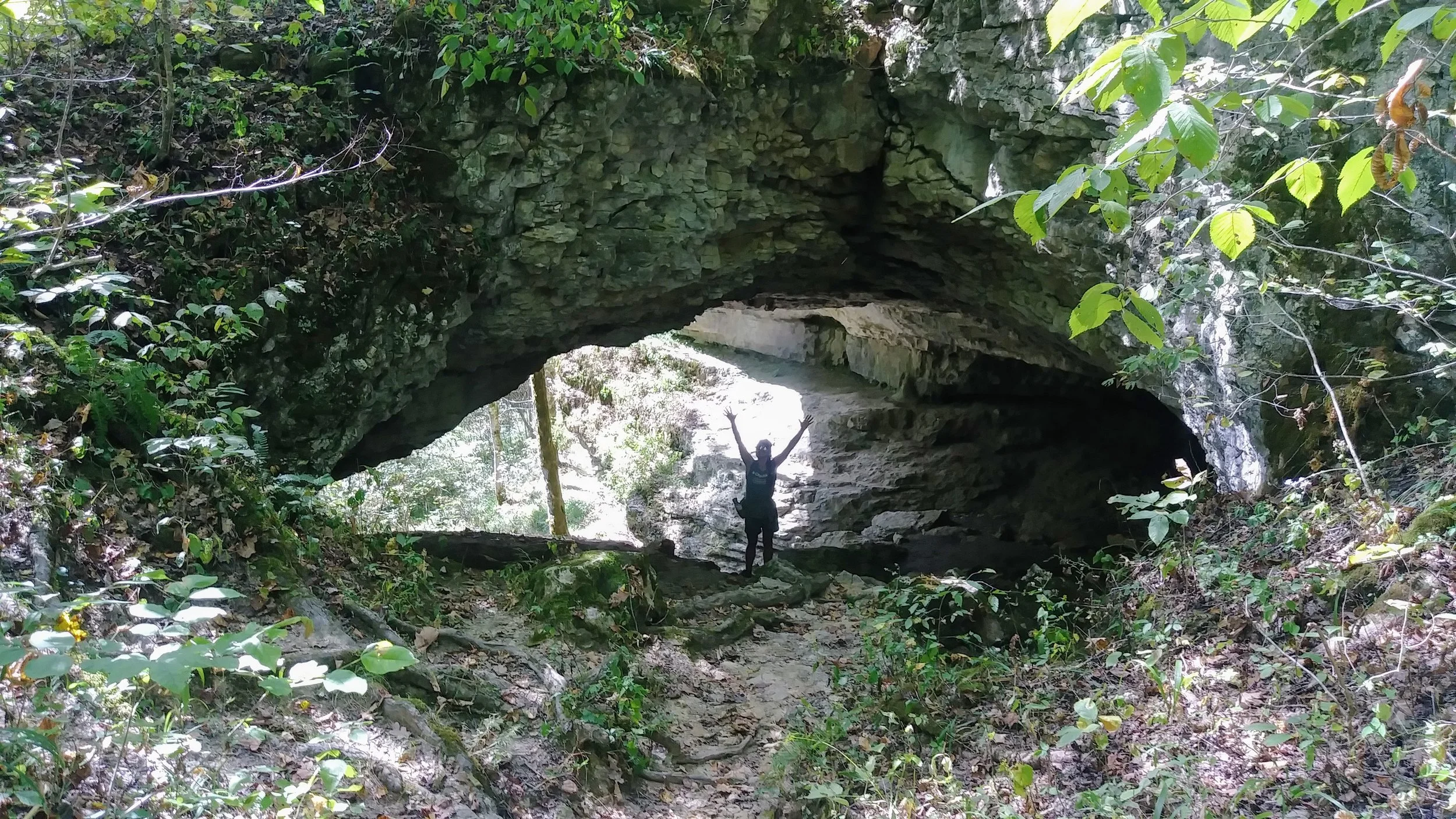
Swift Camp Creek Overlook

Swift Camp Creek Overlook

There are a handful of roadside pull-offs with big views in Red River Gorge. This particular one is among the best with a very short unmarked trail leading to a nice perch overlooking Swift Camp Creek below. It’s a small piece of rock - perfect for couples or you and your bestie.

Read More

2019 Georgia Jewel 35-miler

After volunteering at this race a few years ago, I finally had the chance to run it. Under the care of Jenny and Franklin Baker, this event has become a sellout and with so many good reasons - awesomely run-able, but challenging course, amazing volunteers, well-stocked aid stations, and as I found, Mount Baker might be the best part.

Read More

Adair WMA - East Loop

Adair WMA - East Loop

Next door to Big Bone Baptist Church is Adair Wildlife Management Area (WMA). We decided to take advantage of this long dry spell to do some arrowhead hunting and hiked the dried up stream beds on the eastern half of the area. This time of year, it’s a guaranteed bushwhack, so be prepared and don’t wear anything nice:-)

Read More

Tar Kiln Ridge to Above Military Wall

Tar Kiln Ridge to Above Military Wall

I’ve been wanting to do this hike for some time, and today was the day. It was BRUTALLY AWESOME! 90-degree heat, sun-soaked ridgeline, badly overgrown trail, tons of deadfall, maximum skin destruction, scrambling, crawling on all fours…yup, it was GREAT!!! And that view at the end? Hard won and worth all the challenges.

Read More

Tarr Ridge to First Overlook

Tarr Ridge to First Overlook

Starting from the trailhead at the northern entrance to Red River Gorge Geological Area on Tarr Ridge Road (KY-77), this short hike provides an awesome view of the gorge along with a grand variety of fungus along the trail. With plenty of backcountry campsites along the way and additional viewpoints further out, this is a great place to explore.

Read More

Sheltowee Trace Day 4 - Stony Cove Picnic Area to Clear Creek Campground and EXIT

Sheltowee Trace Day 4 - Stony Cove Picnic Area to Clear Creek Campground and EXIT

Horses destroy trails - especially if it’s been rainy, and it’s been very rainy in Kentucky this year. This section of trail is an unmitigated disaster with miles and miles of hoof-pocked mud pits that are very nearly impassable for hikers. It was the worst hiking I have experienced and led to us ending our backpacking trip 35 miles early. I suggest hiking this section in the spring BEFORE horse season begins on the trails.

Read More

Sheltowee Trace Day 4 - Amburgy Rocks to Stony Cove Picnic Area

Sheltowee Trace Day 4 - Amburgy Rocks to Stony Cove Picnic Area

This was a fantastic walk in the woods with a gentle descent to Cave Run Lake. The views from the dam are the best of the first nine sections (46-ish miles) of the Sheltowee Trace. We stopped in at the visitor’s center to restock water and enjoyed lunch at Stony Creek Picnic Area. Bork had a nice, cooling swim as well.

Read More

Sheltowee Trace Day 3 - Morehead to Amburgy Rocks

Sheltowee Trace Day 3 - Morehead to Amburgy Rocks

This section of the hike took us through downtown Morehead where we resupplied at a gas station and IGA. After town, it’s a good stretch of road before heading back into the forest where we made camp at Amburgy Rocks. The campsite alone was worth the hike - sitting atop a rock outcropping enjoying the breeze…and a thunderstorm as it turned out.

Read More