Sheltowee Trace Day 4 - Amburgy Rocks to Stony Cove Picnic Area
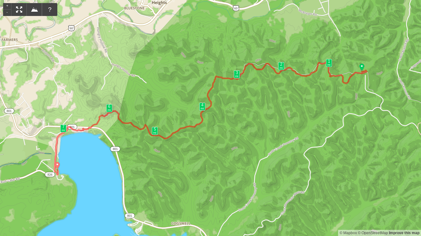
/Map of Sheltowee Trace Day 4 - Amburgy Rocks to Stony Cove Picnic Area
Elevation Profile of Sheltowee Trace Day 4 - Amburgy Rocks to Stony Cove Picnic Area
Overview. This was a fantastic walk in the woods with a gentle descent to Cave Run Lake. The views from the dam are the best of the first nine sections (46-ish miles) of the Sheltowee Trace. We stopped in at the visitor’s center to restock water and enjoyed lunch at Stony Creek Picnic Area. Bork had a nice, cooling swim as well.
Route Type | Point to Point
Total Distance | 7.75 miles
Overall Difficulty | Moderate
Sheltowee Trace Section 8 Info from USDA Forest Service
Sheltowee Trace Section 9 Info from USDA Forest Service
Sheltowee Trace Map from USDA Forest Service
Trailhead. We started our hike at Amburgy Rocks where we camped the night prior. It has a small parking lot that is accessible through a Forest Service Road off of Clack Mountain West Road. [map]
Trail navigation. The trail is clearly marked and moves westbound with many intersecting mountain biking trails along the way. Stay on trail #100 and avoid turning off onto any of the #109 loops. You’ll stay on the trail until finally hitting pavement past the visitor’s center to walk across Cave Run Dam.
Water. Cave Run Lake is the last reliable water until reaching Clear Creek Campground. Be sure to resupply here for the 10 mile journey to the campground. NOTE: if taking the route that meanders along Cave Run Lake, there may be more opportunities to filter water, but we went the other way based on the map we had with us.
Visitor’s center/district office. Looking back, we should have gotten more use out of the visitor’s center that we used to resupply our depleted water stock. It’s air conditioned, has shaded picnic tables, a nice deck off the back, and bathrooms. Definitely should have used the bathroom there because Stony Cove has port-o-lets. Air conditioned bathrooms are amazing on hot summer days; port-o-lets, not so much.
Cave Run Lake and Licking River head waters. By far, the best views of the hike, the walk across Cave Run Dam provides a beautiful vista of the lake on the left side and the head waters of the Licking River on the right. There is a highly developed picnic area on the Licking River side, but it’s a fairly steep descent so we opted for Stony Cove Picnic Area instead.
Stony Cove Picnic Area. This area was a disappointment compared to the information published online and compared to the picnic area we saw on the other side of the dam. While there were, in fact, bathrooms, they were port-o-lets. On a sunny summer day, it was hot, steamy, and super smelly. In addition, all the picnic areas were exposed to the sun. The OTHER picnic area had covered picnic tables and flush toilets that were likely air conditioned too. Meh, next time, right? Oh, and what about that seasonal retail bit on the fish and wildlife site? Nope.


