
Rock Bridge Arch
/
Rock Bridge Arch in May
Overview. This is among the easiest hikes in the Red River Gorge Area and is beginner/family friendly. In less than 1.5 miles, you'll see a large rock shelter, Creation Falls, a beach, and Rock Bridge Arch. This is a particularly great hike over the summer when you can wade through the water and spend some time relaxing on the beach below the falls.
Route Type: Loop
Total Distance: 1.5 miles
Overall Difficulty: Easy
USDA Forest Service Trail Map
USDA Forest Service Trail Map of Red River Gorge Area
Trailhead. Turn east off KY-715 onto Rock Bridge Road and follow it to the trailhead parking lot and picnic area. [map]
Trail Navigation. From the south trailhead, follow this loop counterclockwise for a 1.5 mile loop. At the junction with Swift Camp Creek Trail, continue straight (northwest).

Map of Rock Bridge Arch Trail
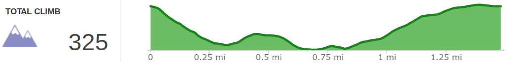
Elevation profile of Rock Bridge Arch Trail

Sign at south trailhead of Rock Bridge Arch Trail

Wildflowers in bloom on Rock Bridge Arch Trail in May

Creation Falls from Rock Bridge Arch Trail

The wife standing atop Rock Bridge Arch