Auxier Ridge - Double Arch Loop
/Overview. This hike has the biggest views in Red River Gorge. In a word, it’s spectacular. The loop will take you along two ridgelines where you’ll see where you’re going and where you’ve been. In the Fall, this is the place to be.
Route Type | Loop
Overall Difficulty | Moderate
Total Distance | 8+ miles
USDA Forest Service Map of Red River Gorge Area
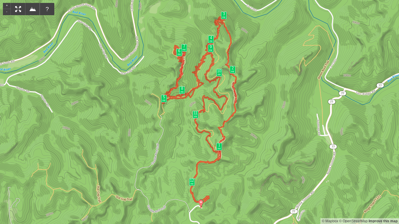
Trailhead. This hike begins at the Auxier Ridge Trailhead at the end of Tunnel Ridge Road of KY-15. [map]
Trail navigation. The loop is all on well-marked trails with only a handful of side trails. The rule on this is if there’s no trail sign, keep going straight on the main path. You’ll begin on Auxier Ridge Trail and follow it a little more than two miles to the end where you’ll make a left (west) to head down on Auxier Branch Trail. From there, you’ll reach the stream where you can top off water. Next you’ll move uphill to reach the intersection with Double Arch Trail. Make a right (north) to skirt around the ridge before looping past the arch and uphill. Coming around the arch, you’ll see it once you near the ridgeline. Here, you can scramble up to the top of the arches to enjoy a full view of your surroundings. Take your time here before retracing your steps to the intersection with Auxier Branch Trail. Turn left to continue retracing and follow it out until reaching the next trail intersection with Courthouse Rock Trail. Make a right (southeast) here to begin climbing out of the gorge. This starts gently, but toward the end, it becomes a steep, sun exposed finish before reuniting with Auxier Ridge Trail. Make a right at this final intersection and continue back to the trailhead.
Shorter option #1 - Auxier Ridge. You can cut your hike by more than half by hiking Auxier Ridge to Courthouse Rock. This is the most famous ridge in Red River Gorge with two massive rock outcroppings where you can sit and take it all in. [more]
Shorter option #2 - Double Arch. With arguably better views from the Observatory above Double Arch, you can cut your hike down to about 4.4 miles with much of it on easier-to-travel gravel road. I love this hike just as much as Auxier Ridge, so it’s a coin flip. [more]
Sky Bridge Station. After this hike, you’ll feel it in your legs. Replenish yourself with an ice cold Kentucky beer and an Aztec quesadilla at Sky Bridge Station.
Ignore the GPS mileage above. It must’ve been a rough day for the GPS:-) This hike isn’t anywhere near 12 miles, but as you can see from the zig-zags, GPS isn’t perfect by any stretch.


